Measured Building Surveys

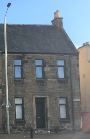
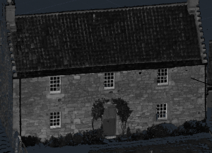
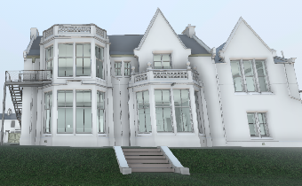
Client’s now preparing for future developments, with high demand for floorplans, elevations and land holding surveyed, to get on with their designs of the future.

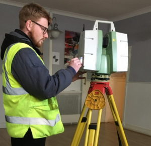
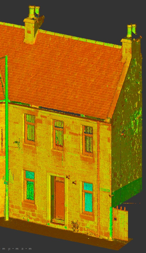
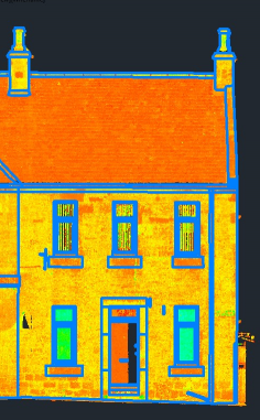
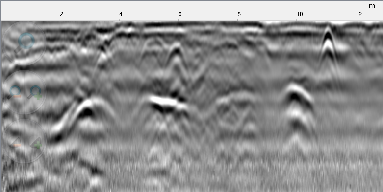
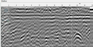
Using most of the tools of the trade to achieve client needs; GPS, Total Station, disto, & Laser scanners to capture and map client’s homes and commercial premises rapidly.

Comments Off on Measured Building Surveys

We are Recruiting!

Mason’s are recruiting ;

  • Land & Measured Building Surveyors
    • Experienced and Junior roles
  • Utility Surveyors
    • with Topographic experience also
  • Laser Scanning Surveyors
    • with Topographic experience and CAD ability

Working from our Dunfermline office or London Heathrow ,  send us your C.V. and perhaps you’re the person (s) we are looking for, to join our growing team!

Applications to: info@masonsurveys.co.uk


Comments Off on We are Recruiting!

GPR utility detection & mapping

Ground penetrating radar for scanning in real-time; pipes and anomolies that are below your site surface.

Recent works detecting pipelines and drainage runs carried out across Scotland and the UK for planning development and re-development inside  buildings, outside in open ground as well as upon developed land.

Vist our UGS page to find out more about our service.

Comments Off on GPR utility detection & mapping

Laser Scanning (2D & 3D output)

Scanning properties to aid their re-development with rapid field solutions is always beneficial. The processing of such amounts of 3D data is another matter, however our new purchase proved its worth and additional scanners were present to help work with tight timescales.

3D point clouds to generate 2D plans and to create 3D Revit models.

Visit our scanning page to find out more about our services.

Comments Off on Laser Scanning (2D & 3D output)

Christmas 2020

Mason Surveys is closed from the 22nd December 2020, re-opening on the 5th January 2021.

Have a good Christmas break and here’s to a better 2021, from the Mason team!

Comments Off on Christmas 2020

Teamwork!

When a plan comes together its great!

Undertaking EML surveys and CCTV surveys with Pipe clearance at the same site under traffic management – 4 teams from in-house and our partner’s to make it all happen – in the dark.

After the GPR Survey, comes the EML Survey, working at the lowest traffic volume and achieveing a drainage condition survey also, with key partners working together to ensure a tight schedule is met in the field.

Comments Off on Teamwork!

Heavy Vegetation

After the warm weather earlier in the year and of course rain, the vegetation on site had grown a bit..

Our team had more to handle on this occasion and did their best to capture the lay of the land by all means possible; GPS, Total Station and Drone, but as always we wanted to achieve more but were stopped by the vegetation!

Comments Off on Heavy Vegetation

CCTV Inspection & Recording

Recent works checking that sub surface ducts are clear for new cabling undertaken in the central belt. Our camera system allows 60M of colour video inspection and longer,  if required.  Any issues found may be traced with EML detection methods and recorded on the ground surface and or digitally by GPS and Total Station methods.


Comments Off on CCTV Inspection & Recording

London’s – Underground Services

Tracing, verifying and mapping sub surface utilities at various locations in the Capital for our clients, working with EML, GPR push and GPR tow systems to capture a dense area of utilities rapidly and effectively in the field, ahead of post-processing EML/GPR data to create a comprehensive sub surface drawing record.

Comments Off on London’s – Underground Services

Gap Sites

Gap site surveys undertaken! replace old with new and have your gap site surveyed for whatever may be taking place of the original structure.

Surrounding walls, surfaces, remaining structural items for re-use and of course sub surface utilties may all be captured to assist in planning of your site re-development.

Get in touch to enquiry – Gap site survey about our Topographic Surveys and utility detection and clearance surveys.


Comments Off on Gap Sites